Trail Walking Le Fau - GR 400 J5 réel 18 620m +854m - Photo

GR 400 J5 réel 18 620m +854m

© OpenStreetMap contributors
Length
Length
18.6 km
Max alt
Max alt
1548 m
Uphill gradient
Uphill gradient
854 m
Km-Effort
Km-Effort  
30 km
Min alt
Min alt
888 m
Downhill gradient
Downhill gradient
960 m
Boucle
Boucle
No
Creation date :
2021-06-18 06:30:04.744
Updated on :
2021-07-01 19:13:45.232

(0 Reviews)

Walking
Walking
8h38
Difficulty : Very difficult

Scan this QR Code to open this trail in the SityTrail application

FREE GPS app for hiking

Logo SityTrail SityTrail

IGN / Geographical institutes

Download SityTrail from the App Store Download SityTrail from Google Play

Logo SityTrail SityTrail World

The world is yours!

Download SityTrail from the App Store Download SityTrail from Google Play Download SityTrail on Huawei AppGallery

About

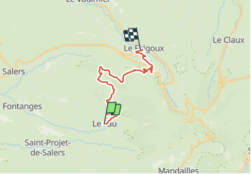
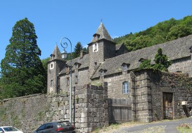
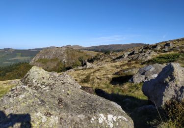
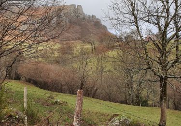
Trail Walking of 18.6 km to be discovered at Auvergne-Rhône-Alpes, Cantal, Le Fau. This trail is proposed by DanielROLLET.

Description

2021 06 18 08h20 à 17h00 Pause 12h30 à 13h00
Nombreux problèmes de marquage
Problème pour monter au Puy Violent
Problème au Violental, ne pas descendre sur la route avec cote 1179, tracé modifié.
Vitesse de progression assez faible.
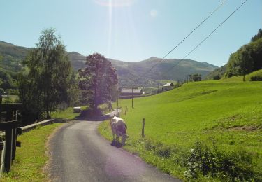
Elevation profile

Positioning

Country:
France
Region :
Auvergne-Rhône-Alpes
Department/Province :
Cantal
Municipality :
Le Fau
Location:
Unknown
Start:(UTM)
467222 ; 4994337 (31T) N.

Trails nearby

Trail On foot Le Falgoux - Sentier de la cascade du Biaguin - Photo
On foot
PRO

On foot

Easy
Le Falgoux, Auvergne-Rhône-Alpes, Cantal, France
3.8 km | 5.5 km-effort
1h 14min
Yes
Trail On foot Saint-Projet-de-Salers - Sur la route des transhumances étape 3 - Photo
On foot
PRO

On foot

Easy
Saint-Projet-de-Salers, Auvergne-Rhône-Alpes, Cantal, France
12.4 km | 17.9 km-effort
4h 3min
No
Trail Walking Saint-Paul-de-Salers - 11.08.2013 - Photo
Walking
robertserre

Walking

Easy
(1)
Saint-Paul-de-Salers, Auvergne-Rhône-Alpes, Cantal, France
10.6 km | 15.6 km-effort
3h 7min
No
Trail Walking Le Falgoux - le falgoux - Photo
Walking
robertserre

Walking

Easy
(1)
Le Falgoux, Auvergne-Rhône-Alpes, Cantal, France
7.8 km | 10.4 km-effort
2h 22min
Yes
Trail Walking Le Fau - Puy violent  - Photo
Walking
sdroneau

Walking

Very difficult
Le Fau, Auvergne-Rhône-Alpes, Cantal, France
22 km | 37 km-effort
8h 29min
Yes
Trail Walking Saint-Projet-de-Salers - Col de Legal Cabrespine  - Photo
Walking
GUIDE
antignacs

Walking

Very easy
Saint-Projet-de-Salers, Auvergne-Rhône-Alpes, Cantal, France
8.2 km | 13.6 km-effort
2h 43min
Yes
Trail Hybrid bike Mandailles-Saint-Julien - Tournemire  - Photo
Hybrid bike
nadd73

Hybrid bike

Medium
Mandailles-Saint-Julien, Auvergne-Rhône-Alpes, Cantal, France
39 km | 50 km-effort
3h 2min
No
Trail Walking Saint-Projet-de-Salers - Col de Legal vers le Puy de Chavaroche - Photo
Walking
tbrunet

Walking

Medium
Saint-Projet-de-Salers, Auvergne-Rhône-Alpes, Cantal, France
8.5 km | 13.8 km-effort
3h 8min
Yes
Trail Walking Mandailles-Saint-Julien - Roches folles - Photo
Walking
GUIDE
amiral13

Walking

Very easy
Mandailles-Saint-Julien, Auvergne-Rhône-Alpes, Cantal, France
7 km | 11.1 km-effort
2h 20min
Yes


Close
My subscriptions